
Pricing Designed for Transparency
We created our pricing plans to eliminate surprises. Every package includes hardware, data, and software, with no hidden costs. We provide communities predictable costs and the confidence that Hohonu will be a long-term partner.
No Hidden Costs
One clear price that's all-inclusive
Predictable Pricing
Easy to plan, budget, and scale
Long-Term Partnership
Built to support and grow with your needs
Step 1: Choose Your Sensor
Reliable and Cost-Effective
-
Proven performance in tidal, river, floodplain sites
-
Remote install support from our team
-
Public access via TideCast web & mobile
-
Operational history (NAVD88 updates, sensor swaps)
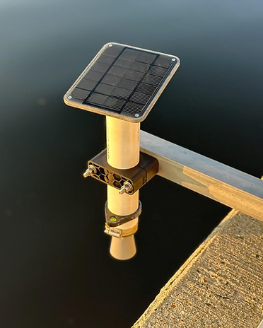
Ultrasonic
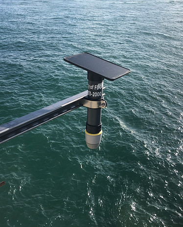
Precise in harsh conditions
-
All Ultrasonic features included
-
Higher accuracy in rain, spray, debris
-
Extended 15 m range for bridges & wide channels
Radar
Everything Included
No hidden fees - Hardware, data, and software bundled with every package
Hardware Support
Leasing, Replacements, Enterprise-Level Support
Data Delivery
Cell-Connected Telemetry From Anywhere
Public Sharing
Public Dashboard and Mobile App for Your Team & Community
Integrations
Seamless API Access for Custom Tools
Step 2: Choose Installation & Maintenance
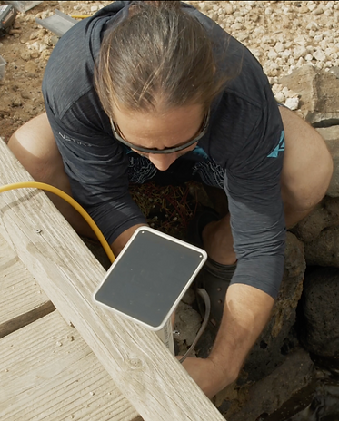
Most cost-effective option
-
Quick installation with remote onboarding
-
Your team retains full control
-
Deploy on your own schedule
Do It Yourself
.jpeg)
Hands-off, worry-free deployment
-
Hohonu hires local subcontractors for you
-
Hardware swaps & maintenance included
-
Predictable ongoing pricing
Fully-Managed
Remote onboarding for your team
Troubleshooting and sensor swaps covered
Option to bring in vetted subcontracted installers as needed
Hohonu Support - Included in Both Options
Get Access to Our Nationwide Network
Unlock real-time water level data from hundreds of sensors across the country through our API.
Nationwide Coverage
One API connects you to flood and tide data everywhere you need it
Trusted Accuracy
Data is continuously monitored and quality-checked for reliability
Ready to Integrate
Plug our insights directly into your planning, modeling, or emergency tools